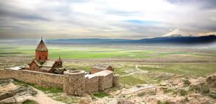
Khor Virap
DESCRIPTION
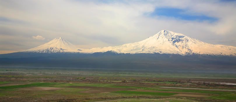
Mount Ararat is located in Eastern Turkey on the borders of Iran, Armenia (formerly U.S.S.R.), and Nachivan. This volcanic mountain rises 5,165 meters or 16,945 feet high above the plains and is the highest location in the ancient kingdom of Urartu, a region which covered thousands of square miles. Ararat is the bastardized name of Urartu from the Hebrew Torah written by Moses (c. 1450 BC) which only included the consonants "rrt". However, the translators of the Bible replaced the "rrt" with the later name, "Ararat." The Assyrians wrote about battles against the Urartian tribes from the thirteenth century BC until the sixth century BC when Urartu was destroyed by the Medes. The name Urartu then vanished from history and was replaced by Ararat and Armenia in the vicinity as well as in Bible translations in English, etc. As history went on in the first and second millenia AD, the mountain became known as Ararat and the region as Armenia. Many people believe that Mount Ararat is the place where Noah's Ark landed but the Bible does not state this. It simply says that the boat landed in the Urartian mountains, of which there are hundreds, although Ararat is the highest. Since Mount Ararat is the highest location in Urartu, some people throughout history have jumped to the unproven conclusion that it was the landing place and promoted that concept as a regional tradition.
Mount Ararat may be the largest single-mass or volume mountain in the world as it is huge (one really has to see it in person to appreciate its immensity) and rises to 17,000 feet from the plains surrounding it at 2,000-3,000 feet while most other large mountains are in a mountain range with less differential and base circumference. Ararat has only a few native trees growing on it in Ahora village and several small forests on Little Ararat. Views differ as to whether Ararat formed much of its size after the flood (post-flood) or during the flood as some geologists like Seventh Day Adventist Clifford Burdick Ph.D. have claimed to find pillow lava (lava spewed into water) around the 14,000-foot level. Some geologists claim that cylindrical mountains like Little Ararat show that it is a post-flood mountain. There are also claims of fossils and sedimentary layers on Greater Ararat but these claims have not been backed up with evidence as of this date although there are fossils near Ararat. From 14,000 feet to 17,000 feet, much of the lava is covered by an ice cap which is about 17 square miles in size and is up to 300 feet deep. As computed by ArcImaging, the coordinates that cover the ice cap area on Mount Ararat are N 39 degrees 41' to N 39 degrees 44', E 44 degrees 15' 30" to E 44 degrees 19' 30". The area of this rectangle is about 31.6 square kilometers.
Mount Ararat may be the largest single-mass or volume mountain in the world as it is huge (one really has to see it in person to appreciate its immensity) and rises to 17,000 feet from the plains surrounding it at 2,000-3,000 feet while most other large mountains are in a mountain range with less differential and base circumference. Ararat has only a few native trees growing on it in Ahora village and several small forests on Little Ararat. Views differ as to whether Ararat formed much of its size after the flood (post-flood) or during the flood as some geologists like Seventh Day Adventist Clifford Burdick Ph.D. have claimed to find pillow lava (lava spewed into water) around the 14,000-foot level. Some geologists claim that cylindrical mountains like Little Ararat show that it is a post-flood mountain. There are also claims of fossils and sedimentary layers on Greater Ararat but these claims have not been backed up with evidence as of this date although there are fossils near Ararat. From 14,000 feet to 17,000 feet, much of the lava is covered by an ice cap which is about 17 square miles in size and is up to 300 feet deep. As computed by ArcImaging, the coordinates that cover the ice cap area on Mount Ararat are N 39 degrees 41' to N 39 degrees 44', E 44 degrees 15' 30" to E 44 degrees 19' 30". The area of this rectangle is about 31.6 square kilometers.
Mountain Ararat